About the project
Air pressure measurements are performed every hour within standard meteorological monitoring procedures, or every 10 minutes on the automatic meteorological stations operated by the Meteorological and Hydrological Service. However, a detection of the high-frequency atmospheric phenomena, which may have a substantial impact to the sea and coastal regions, needs to have measurements on one minute or even second timescales. One of the processes, which are occasionally occurring in the Adriatic Sea at these frequencies, are so-called meteorological tsunamis. For that reason a network of microbarographs is installed in Vis, Vrboska and Vela Luka.
Meteorological tsunamis are tsunamis which have the origin in the atmosphere. Precisely, mesoscale atmospheric disturbances may be created during some specific atmospheric conditions and travel coherently over the sea. They may be visible in surface air pressure measurements, and an exceptionally rapid changes can be detected (up to 7-8 hPa over 30 min). If these disturbances are moving over shelf seas, they may excite long ocean waves having the same speed as the atmospheric disturbance (e.g. the speed of 22 m/s is equivalent to the speed of long ocean waves in 50-m deep sea). If both atmospheric disturbance and long ocean wave speeds are similar, the amplification of the ocean waves is rapid (effect called Proudman resonance, according to the theoretical paper from 1929). The generated long ocean waves are additionally amplified by topography, and may reach 1 m when hitting the coastal areas. The last stage of amplification is co-called harbour resonance, which implies that the incoming waves have significant energies at the harbour or bay normal mode periods. If the amplification of the harbour or bay is large, the waves at its head may reach several meters. And if the tides are relatively small, such as in the Mediterranean, coastal infrastructure is not adopted to rapid sea level changes, resulting in costal floods and damages in so-called hot-spots.
Several large meteotsunamis have been recorded in the Adriatic Sea in the last couple of decades: Vela Luka in June 1978, Stari Grad and Mali Ston in June 2003, Ist in August 2007 and Mali Lošinj in August 2008. The first listed event was characterized by the ocean waves having period of approx. 15 min and height of 6 m, which flooded much of the Vela Luka city and resulted in quite large damage. The flooding of Stari Grad was of less intensity, but the shellfish farms in Mali Ston Bays where destroyed due to severe currents occurred during the wave passage. The Ist meteotsunami in 2007 was characterized by 4-m high wave observed in Cove Široka, while the Mali Lošinj meteotsunami flooded the promenade and the frontline houses.
In the Mediterranean this phenomenon has been also documented on the Balearic Islands (Menorca), Malta and Sicily, and Greece, while a number of destructive meteotsunamis were recorded in the World Ocean: Nagasaki Bay in 1979 – 5-m waves drowned 3 persons, China, New Zealand, Baltic, Argentina and the Great Lakes – “tidal wave” flooded Chicago and other coastal areas in 1954, having a death toll of at least 7 persons.
Therefore, pilot network of microbarographs is established within the research project covering unusual Adriatic dynamics, which will precisely measure high-resolution changes in air pressure at three stations in the middle Adriatic (Vis, Vrboska, Vela Luka). The core of the stations is the Vaisalaa air pressure sensor which can take the sampling every 1 s with accuracy of 0.01 hPa. The data are stored on the Axis computer, being transferred to the MEDAS database located in the Institute of Oceanography and Fisheries every hour.
Geometry of the network is allowing for the detection of rapid air pressure changes, and enables estimation of their coherency, speed and propagation direction over the middle Adriatic. The network will be extended in the future with new microbarographs and tide gauge stations, being operational in real-time and enabling the warning, alerting and mitigating of the population and adopting the infrastructure prone to destructive meteotsunamis.
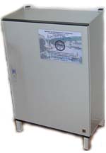
Measuring station
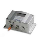
Vaisala sensor